
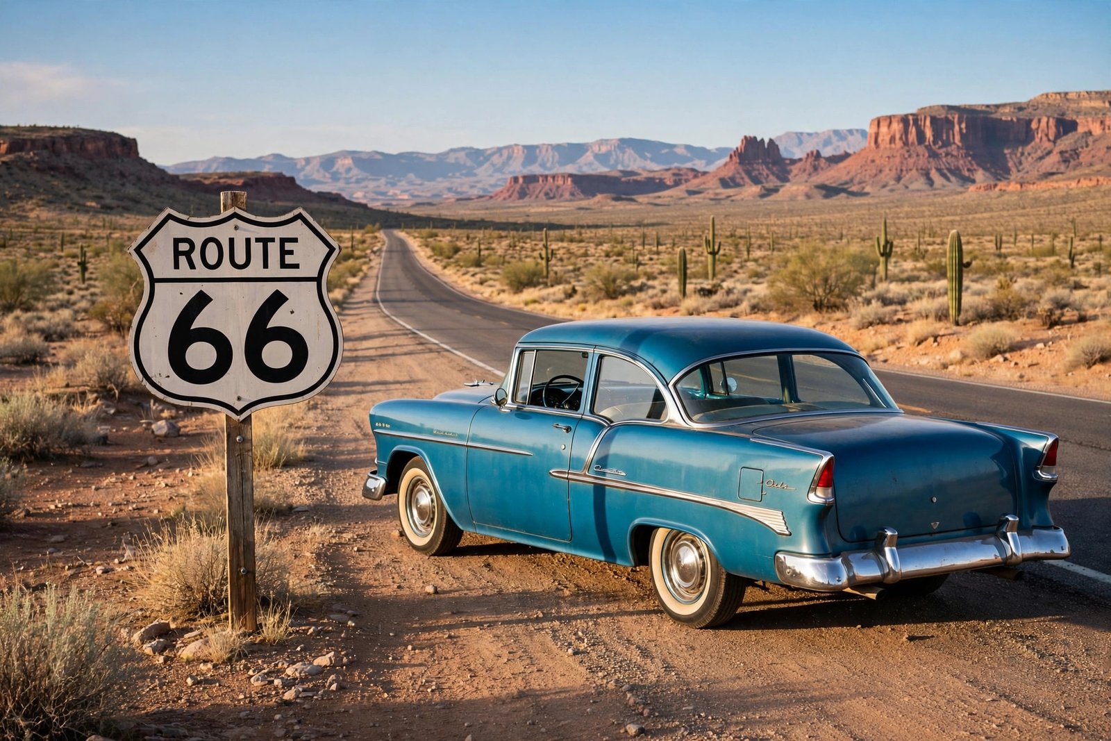
There is a road in America that no longer officially exists, yet millions of people still dream of driving it. Route 66, the Mother Road, runs from the skyscrapers of Chicago to the Pacific Ocean at Santa Monica, crossing eight states, three time zones, and just about every landscape the American continent can offer. Born in 1926, it carried Dust Bowl families west in the 1930s, powered the great postwar road trip boom, and was taken off the federal highway map in 1985. Today, about 85 percent of the historic alignment is still drivable, marked with brown Historic Route 66 signs and kept alive by small towns, neon motels, and diners.
This guide covers the history, the route state by state, the stops worth your time, the best seasons to go, and the practical details that turn a good idea into a great trip. You do not need a vintage car or a month of vacation to enjoy Route 66. You need a plan, a little patience, and a willingness to slow down.
What Is Route 66? A Short History
Route 66 was one of the original highways of the United States Numbered Highway System. The number was assigned on April 30, 1926, and U.S. Route 66 was officially commissioned on November 11, 1926. The original alignment ran 2,448 miles from downtown Chicago, Illinois, to Santa Monica, California, crossing Illinois, Missouri, Kansas, Oklahoma, Texas, New Mexico, Arizona, and California. The number itself came from a small piece of American politics: the Chicago-to-Los Angeles route was first designated U.S. Highway 60, but Kentucky objected because its own road already carried that number. After the number 62 was also floated, promoters Cyrus Avery of Tulsa, Oklahoma, and John Woodruff of Springfield, Missouri, sent a telegram to federal authorities proposing the number 66. The proposal was approved, and Springfield, Missouri, is still recognized as the birthplace of Route 66.
In its early years the road was rough, much of it gravel and dirt, and it was not fully paved until 1938. But it quickly became the main road west. During the 1930s, families fleeing the Dust Bowl drove it toward California looking for work, and John Steinbeck gave the highway its lasting nickname in The Grapes of Wrath, calling it the Mother Road. After the Second World War came its golden age: returning veterans, cheap gasoline, and a booming car culture filled the road with travelers, and the roadside answered with neon-signed motels, diners serving pie and coffee around the clock, and giant statues built to make drivers stop.
The end came gradually. In 1956, President Dwight D. Eisenhower signed the Federal-Aid Highway Act, launching the Interstate Highway System, and over the next three decades five interstates, I-55, I-44, I-40, I-15, and I-10, replaced long stretches of Route 66. The last town to lose its bypass fight was Williams, Arizona, in October 1984, and on June 27, 1985, the highway was formally removed from the United States Highway System. Yet the road never disappeared. Preservationists and the towns along the way kept the old alignment alive as state and local roads, and in 2026 Route 66 celebrates its centennial, one hundred years after it was commissioned.
The Route at a Glance: Eight States, 2,448 Miles
The classic drive runs east to west, from Chicago to Santa Monica, following the direction most travelers take and the direction the road’s history flowed. Here is the shape of the trip:
- Illinois: Downtown Chicago to the Mississippi River, through Springfield, the state capital.
- Missouri: St. Louis and the Gateway Arch, then the Ozarks, caves, rivers, and small towns.
- Kansas: Only about 13 miles, the shortest stretch of any state, through Galena and Baxter Springs.
- Oklahoma: Roughly 400 miles, one of the longest stretches, through Tulsa and Oklahoma City.
- Texas: The Panhandle, through Amarillo and Adrian, home of the Midpoint Cafe.
- New Mexico: Albuquerque, Tucumcari, adobe towns, and wide desert skies.
- Arizona: The Petrified Forest, the Wigwam Motel, and the gateway to the Grand Canyon.
- California: The Mojave Desert, Los Angeles, and the final miles to the Santa Monica Pier.
The route changed over its lifetime: a 1937 realignment through New Mexico bypassed Santa Fe in favor of Albuquerque and shortened it to about 2,280 miles. The 2,448-mile figure is the original 1926 alignment.
How Long Does It Take? Planning Your Pace
The single most important planning decision is how many days to allow. Plan for a minimum of 10 days to drive the full route at a pace that still leaves time for stops. Two weeks is the sweet spot for most travelers, enough to linger at the big attractions without rushing. Three weeks or more gives you a truly leisurely trip with side excursions to places like the Grand Canyon and Santa Fe.
A useful rule of thumb is to cover around 200 miles per day, leaving the rest of each day for the diners, photo stops, and detours that are the whole point. The pure driving time is roughly 35 to 40 hours if you drove straight through, but that would miss everything that makes the road worth doing. If you only have a week, drive one strong half instead of rushing the whole thing, and build in a buffer day or two for discoveries and weather delays.
When to Go: The Best Time to Drive Route 66
The route crosses deserts, plains, and mountains, so the weather varies enormously from one end to the other. The two best windows are late spring, roughly April into early June, and early fall, September into October. In those months the weather is mild across all eight states, the desert heat has not peaked or has already broken, and the crowds are smaller than in peak summer. Late spring brings blooming landscapes and long daylight hours. Early fall brings comfortable driving, softer light for photographs, and fall color beginning to show in the Midwest while the Southwest stays warm and golden.
Summer is doable, and it is when most families travel, but July and August bring serious desert heat through the Southwest and the biggest crowds. Drive in the cooler morning and evening hours, keep water in the car, and book stays early. Winter is possible, but snow can close higher-elevation sections in New Mexico and Arizona.
The Drive State by State
Illinois begins in downtown Chicago, at Adams Street and Michigan Avenue, where the historic start sign draws travelers for a first photograph. From there the road runs southwest through Joliet, past the Gemini Giant muffler man statue, and through Springfield, home to the Abraham Lincoln sites.
Missouri brings St. Louis and the Gateway Arch near the original route, plus the Chain of Rocks Bridge, now a pedestrian path over the Mississippi. West of the city, the road winds through the Ozarks, past Meramec Caverns and small towns that still feel like the 1950s.
Kansas is short but sweet: about 13 miles through Galena, where a restored tow truck helped inspire a character in the Pixar film Cars, and Baxter Springs, home to a Route 66 visitor center.
Oklahoma is the heart of the Mother Road, with Tulsa and Oklahoma City anchoring a stretch that holds the Blue Whale of Catoosa, the Round Barn in Arcadia, and the Route 66 Museum in Clinton. Allow two days here if you can.
Texas crosses the Panhandle through Amarillo, home of Cadillac Ranch and the Big Texan steakhouse, and Adrian, where the Midpoint Cafe sits at the exact halfway point of the route.
New Mexico brings adobe, turquoise, and wide desert light. Albuquerque is the biggest city on this stretch, and Tucumcari, with neon motels like the Blue Swallow, is one of the most atmospheric overnight stops on the route.
Arizona holds the finest surviving stretches of original pavement in the country, including the long run from Ash Fork to Topock through Seligman and Kingman, and the winding Sitgreaves Pass road between Oatman and Kingman. The Petrified Forest sits right on the corridor, and the Wigwam Motel in Holbrook offers one of the most memorable nights on the road.
California finishes the journey with the Mojave Desert, Barstow, and the long run into Los Angeles, ending at the Santa Monica Pier, where a sign marks the end of the trail and the Pacific stretches out ahead. A road that began beside Lake Michigan ends beside another ocean.
Iconic Stops You Should Not Miss
Cadillac Ranch, Amarillo, Texas. Ten Cadillacs from 1949 to 1963 stand buried nose-first in a Texas wheat field, at the same angle as the Great Pyramid of Giza, painted and repainted by visitors who bring their own spray cans. It is free to visit and unlike anything else in America. Bring a can of spray paint and leave your mark.
The Blue Whale of Catoosa, Oklahoma. A concrete whale in a small swimming pond, built in the early 1970s by Hugh Davis as an anniversary gift for his wife, Zelta, who collected whale memorabilia. It became a beloved swimming hole and then a Route 66 icon. It is free, cheerful, and the finest 15-minute detour in Oklahoma.
The Gateway Arch, St. Louis, Missouri. The Arch stands close to the original route and is worth the stop for the tram ride to the top and the museum underneath, which tells the story of westward expansion.
The Wigwam Motel, Holbrook, Arizona. Fifteen concrete wigwam-shaped cabins, built in 1950, arranged in a semicircle with vintage cars parked outside. It is one of only two remaining Wigwam Motels in the United States, the other is in Rialto, California, and it is listed on the National Register of Historic Places. It is a genuine piece of roadside history.
Petrified Forest National Park, Arizona. This is the only national park in the country that contains a section of Historic Route 66. The scenic Petrified Forest Road runs through the park, and near the point where it meets the interstate, a row of old wooden telephone poles marks where the Mother Road once ran, along with a 1932 Studebaker placed as a memorial to the highway. The park holds ancient petrified wood, fossils, and the colorful badlands of the Painted Desert. Plan at least half a day here.
Where to Sleep and Eat
Route 66 is famous for its motels, and staying in them is part of the experience. The Blue Swallow Motel in Tucumcari, New Mexico, the Wigwam Motel in Holbrook, and the many neon-signed motor courts along the way offer something no chain hotel can: a room with history and a neon sign glowing outside your window. Book classic motels in advance during peak season, because many are small, independently run, and popular with Route 66 enthusiasts from around the world.
The food is just as much a part of the trip: diners serve breakfast all day and pie by the slice, and the best meals are the ones served at a counter by someone who has been feeding travelers for decades.
Practical Tips for the Road
First, get a proper guide. GPS cannot reliably route the original alignment, and the best single navigation resource is the EZ66 Guide for Travelers by Jerry McClanahan, with its hand-drawn maps and mile-by-mile directions. The Historic Route 66 Association websites for each state also maintain current road condition updates, and they are worth checking before you set out each morning.
Finally, mind the basics. Fill up when you see gas, because stretches of the old road have long gaps between stations. Carry water, keep cash as well as cards, and download your maps offline, because some stretches have weak signal. Check your car before you leave: tires, oil, coolant, and air conditioning all matter on a 2,448-mile desert drive. And slow down. The travelers who love Route 66 most stopped often, talked to locals, and let the road set the pace. The interstates will get you there faster. Route 66 will give you a better story.
Frequently Asked Questions
How long is Route 66?
The original 1926 alignment was 2,448 miles from Chicago to Santa Monica. A 1937 realignment shortened it to about 2,280 miles, so the distance depends on which alignment you follow.
When was Route 66 established?
The number 66 was proposed by telegram on April 30, 1926, and U.S. Route 66 was officially commissioned on November 11, 1926. It was removed from the United States Highway System on June 27, 1985.
Can you still drive Route 66 today?
Yes. About 85 percent of the historic alignment is still drivable, mostly as state and local roads marked with brown Historic Route 66 signs. The rest has been replaced by interstates, so you will need a good guide.
How many days do you need to drive Route 66?
Plan for a minimum of 10 days, and 14 days is the sweet spot for most travelers. Three weeks or more allows a leisurely trip with side excursions. With only a week, drive one half of the route.
What is the best time of year to drive Route 66?
Late spring, from April into early June, and early fall, September into October, are the best windows. The weather is mild across all eight states, the desert heat is manageable, and the crowds are smaller than in peak summer.
Related reading
- Tailgating in America: The Game Day Tradition Explained
- New England Fall Foliage Drives and Towns
- Marfa, Texas: Art Pilgrimage and the Marfa Lights
Route 66 is more than a highway. It is a museum you can drive through, a history lesson with the windows down, and a reminder that America was built by people who kept moving west. A century after it was commissioned, the Mother Road still has something to teach every traveler willing to slow down and listen. Plan your trip, pack your patience, and go see it while the neon still glows.