
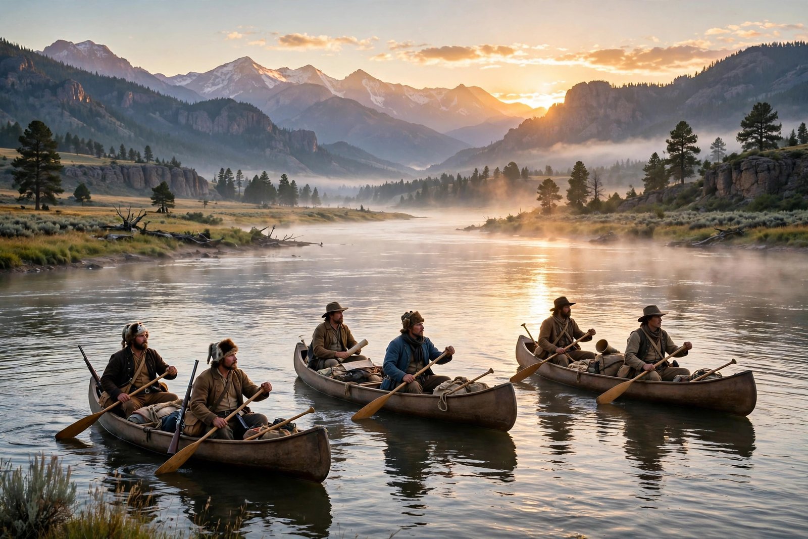
In May 1804, a party of about 45 men set out from Camp Wood, near St. Louis, in a keelboat and two pirogues, heading up the Missouri River into country no American expedition had ever mapped. Their leaders were Meriwether Lewis, President Thomas Jefferson’s private secretary, and William Clark, Lewis’s friend and former army officer. Their mission, from Jefferson himself, was to find a water route to the Pacific, to establish American sovereignty over the newly acquired Louisiana Purchase, to build relations with Native nations, and to record the plants, animals, rivers, and peoples of the West. Over the next 28 months, the Corps of Discovery would travel roughly 8,000 miles round trip, cross the Rocky Mountains, reach the Pacific Ocean, and return to St. Louis with maps, journals, and specimens that changed how America understood its own continent. It remains one of the greatest expeditions in American history, and one of the most human stories ever told about the frontier.
The expedition began with the Louisiana Purchase of 1803, in which the United States bought more than 830,000 square miles from France, doubling the size of the nation. Jefferson had long dreamed of exploring the West, and the purchase gave him both the reason and the territory. In January 1803, he appointed Lewis to lead the expedition, and Lewis invited Clark to serve as co-commander. The two men were opposites in temperament, Lewis introspective and scientific, Clark practical and steady, but they worked in remarkable harmony throughout the journey, sharing command in a way that was unusual for a military expedition and essential to its success.
Up the Missouri: the first year
The Corps of Discovery left Camp Wood on May 14, 1804, and spent its first months traveling up the Missouri River through what is now Missouri, Kansas, Iowa, Nebraska, and South Dakota. The party included 27 young, unmarried soldiers, boatmen, interpreters, Clark’s enslaved man York, and Lewis’s Newfoundland dog, Seaman. They recorded everything: river currents, weather, plants, animals, and the Native nations they met. They described animals new to Euro-American science, including the pronghorn, the prairie dog, and the mule deer, and they held councils with Native leaders, presenting medals and gifts and explaining that the land now belonged to a new great father in Washington.
The expedition’s only death came early. Sergeant Charles Floyd died on August 20, 1804, near present-day Sioux City, Iowa, most likely from a burst appendix, and he was buried on a bluff above the river. His death was a reminder of how fragile the enterprise was: hundreds of miles from any doctor, the party relied on Lewis’s medical training and on the knowledge of the Native peoples they met. In late October 1804, the expedition reached the earthlodge villages of the Mandan and Hidatsa peoples near present-day North Dakota, and there it built Fort Mandan and settled in for the winter. That winter proved decisive. The party rested, repaired equipment, copied journals, and learned about the geography ahead from Mandan and Hidatsa hosts, without whose knowledge the expedition might well have failed.
It was at Fort Mandan that the expedition gained its most famous member. The party hired French trapper Toussaint Charbonneau as an interpreter, and his young Shoshone wife, Sacagawea, joined the group with her newborn son, Jean Baptiste. Sacagawea’s presence proved invaluable in ways that went far beyond translation. Her knowledge of Shoshone territory, her ability to identify edible plants, and her calm presence in councils with Native nations, where a party traveling with a woman and a baby was read as peaceful rather than warlike, all helped the expedition succeed. When the party later needed horses from the Shoshone people, Sacagawea’s reunion with her own people, including her brother, who was now a chief, made the negotiation possible.
To the Pacific: mountains, rivers, and hardship
On April 7, 1805, the expedition sent its keelboat back to St. Louis loaded with specimens, letters, reports, and maps, and continued west in two pirogues and six dugout canoes. The party now numbered about 33 permanent members. The months that followed were the hardest of the journey. At the Great Falls of the Missouri in June 1805, the party spent nearly a month portaging around a series of towering waterfalls, hauling boats and supplies overland in brutal heat. In August, they reached the headwaters of the Missouri in the Rocky Mountains and faced the expedition’s greatest crisis: the mountains were far wider and more rugged than anyone had imagined, and there was no easy water route to the Pacific.
The crossing of the Rocky Mountains tested every member of the party. After purchasing horses from the Shoshone, the expedition crossed the Continental Divide at Lemhi Pass, then followed the Lolo Trail across the Bitterroot Range in September 1805, nearly starving in the cold, steep mountains before emerging among the Nez Perce people, who fed and sheltered them. From there, the party built canoes and descended the Clearwater, Snake, and Columbia rivers to the Pacific, reaching the mouth of the Columbia River on November 15, 1805. The sight of the ocean, after eighteen months of travel, must have been overwhelming, and the party voted on where to spend the winter, a vote in which Sacagawea and York both participated, an extraordinary moment of inclusion for its era.
The winter of 1805-1806 at Fort Clatsop, near present-day Astoria, Oregon, was wet, miserable, and monotonous. The party ran low on supplies, its clothes rotted in the constant rain, and elk and roots made a dreary diet. But the journals kept flowing, and the party prepared for the return journey with the same discipline that had carried it west. On March 23, 1806, the expedition began the long trip home.
The return and the legacy
The return journey was faster but not without danger. The party split in July 1806 to explore different routes, and Lewis was accidentally shot in the leg by one of his own men during a hunting accident in August. A clash with Blackfeet warriors in late July left two Blackfeet dead and forced a hurried retreat. By mid-August, Lewis and Clark had reunited, and on September 23, 1806, the expedition arrived back in St. Louis to a hero’s welcome. The city celebrated for days, and Jefferson received the journals, maps, and specimens with delight.
The scientific legacy of the expedition was immense. Lewis and Clark described at least 178 plants and 122 animals, and discovered about 128 species new to science, including flowers that would become state flowers for Oregon, Idaho, and Montana. They made the first systematic records of the Missouri River’s course, the meteorology of the West, and the geography of the Rocky Mountains and the Pacific Northwest. Clark’s maps, drawn from his own surveys and from information provided by Native guides, were the most accurate maps of western North America available for decades, and they guided fur traders, settlers, and later explorers.
The human legacy is more complicated, and modern historians tell it more honestly than earlier generations did. The expedition depended at every stage on Native knowledge, hospitality, and diplomacy, from the Mandan and Hidatsa winter to the Shoshone horses to the Nez Perce rescue. Yet the expedition also served as an advance guard for American expansion, and the decades that followed brought disease, displacement, and broken treaties to many of the nations the Corps had visited. The Lewis and Clark National Historic Trail, established in 1978 and running nearly 4,900 miles from Pittsburgh to the Pacific, now tells that fuller story, honoring the expedition’s achievements while acknowledging its costs and the peoples whose homelands it crossed.
Today, visitors can follow the trail through national parks, historic sites, and museums, from the Knife River Indian Villages in North Dakota, where two of the earthlodge villages the expedition visited still stand, to Fort Clatsop in Oregon, where the winter camp has been reconstructed. The journals of Lewis and Clark, published and republished for two centuries, remain astonishing reading: daily records of wonder, hardship, humor, and endurance, written by men who knew they were witnessing a continent for the first time and who wrote it all down so the rest of us could see it too.
Frequently asked questions
When did the Lewis and Clark Expedition take place? The expedition ran from 1803 to 1806, with the main journey from May 14, 1804, to September 23, 1806, lasting about 28 months.
How far did Lewis and Clark travel? Approximately 8,000 miles round trip, from St. Louis to the Pacific Ocean and back.
Who was Sacagawea? A young Shoshone woman who joined the expedition at Fort Mandan with her husband, Toussaint Charbonneau, and her infant son. She served as a guide and interpreter and helped secure horses from the Shoshone people.
Did anyone die on the expedition? Only one member, Sergeant Charles Floyd, who died in August 1804 near present-day Sioux City, Iowa.
Can I follow the Lewis and Clark Trail today? Yes. The Lewis and Clark National Historic Trail runs nearly 4,900 miles from Pittsburgh, Pennsylvania, to the Pacific coast near Astoria, Oregon, and is administered by the National Park Service.
Related reading
- The Gettysburg Address: Lincoln’s 272 Words That Remade America
- Buffalo Soldiers: America’s First Black Regiments
- The Interstate Highway System: Surprising Facts
Sources: National Park Service: Lewis and Clark Basic Facts, National Park Service: Lewis and Clark at Knife River.